Images

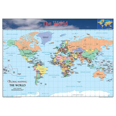
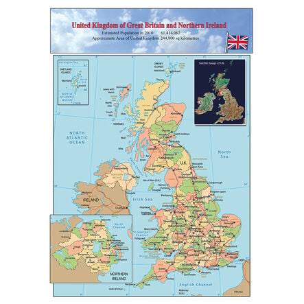
World Europe and UK Maps Set A3

Product Code: GMAC
A three-map set depicting The World, Europe, and the UK, crafted for enriching geographic learning.
Read more

Product Actions

Add to cart options

Variations

Please make all your selections
£19.99 ex VAT £ 19.99 inc VAT

In Stock

Technical Summary

Overview

Helping to Support Teaching and Learning

Durable Laminated Finish

These high-quality maps feature a durable laminate finish designed to withstand regular handling, making them a practical choice for active classroom environments.

Geographical Detail

These maps provide clear and precise markings of major countries, cities, landmarks, and population data which facilitates an engaging and informative geographical reference.

Supports Key Stage Learning

The maps are particularly useful in supporting locational knowledge and geographical skills as part of the Key Stage educational objectives.

Visual Learning Aid

With detailed depictions of geographical regions, these maps serve as effective visual aids that assist in teaching geographical locations and features.

Curriculum Integration

Each map assists in the location and description of various geographical features, effectively supporting the relevant parts of the Geography curriculum.

Your TTS photos

Tag your photos #takingoverTTS

World Europe and UK Maps Set A3

A three-map set depicting The World, Europe, and the UK, crafted for enriching geographic learning.

Overview

  • This set of three maps, showcasing The World, Europe, and the UK, serves as an excellent tool for teaching a variety of geographical concepts.

  • The world map enables educators to explain global positioning, continents, and oceans, enhancing children's global awareness. The Europe map provides a detailed view of political boundaries, major cities, and physical features, ideal for in-depth regional studies. By using the UK map, students can familiarise themselves with their own country’s geographical layout and major landmarks.

  • Designed with a durable laminate finish, these maps are equipped to handle frequent use in busy classroom settings. They offer clear and accurate geographical representations that are essential in promoting an understanding of world geography linked directly to the UK curriculum, ideal for Key Stage 1 and 2 learners.

Supports the National Curriculum

Geography, Key Stage 2, Geographical Skills & Fieldwork

Use maps, atlases, globes and digital/computer mapping to locate countries and describe features studied.

Geography, Key Stage 1, Geographical Skills & Fieldwork

Use world maps, atlases and globes to identify the United Kingdom and its countries, as well as the countries, continents and oceans studied at this key stage.

Geography, Key Stage 2, Locational Knowledge

Locate the world’s countries, using maps to focus on Europe concentrating on their environmental regions, key physical and human characteristics, countries, and major cities.

Technical Summary

Overview

    Pack size

  • 3

  • Material

  • Laminate

  • Age Range

  • Suitable for 5 to 11 years

Size and measurements

    Paper size

  • A3

Questions

Reviews