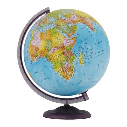
Economy Political World Globes with Stand
https://www.tts-group.co.uk/economy-political-world-globes-with-stand/1038573.html Product Code: make all selections to view product codePromotions
Product Actions
Product Information
 Bulk Packs
Helping to Support Teaching and Learning
-
Political Cartography
The globe’s detailed political cartography clearly marks boundaries and over 2,500 place names, making it an effective tool for teaching locational knowledge.
-
Durable Base
Constructed from durable plastic, the base provides stability and longevity, ensuring the globe remains a reliable classroom resource.
-
Clear Labelling
Continent and ocean names are labelled in a larger font, making them easy to read and identify. Capital cities are emboldened and marked with a larger black star.
-
Ocean Features
Relevant ocean features such as ridges, rises, trenches, and basins are included, providing comprehensive geographical information.
-
Locational Knowledge
Supports Key Stage 2 geography by helping children name and locate counties and cities of the United Kingdom, geographical regions, and their characteristics.


