
A lot has moved on since I outlined ’12 things to think about’ in a 2016 blog. That is certainly true of the world around us, the focus and central concern of Geography. It is also true of the ways in which primary schools are thinking about their foundation subjects.
The second part of this blog reflects on present priorities for Geography, looking at Implementation and Impact.
Part 1 looks at Intent – we suggest you read it before looking at this one.
Implementation
When it comes to the lessons and activities that you do with children in order to meet the intended aims and outcomes that you have prioritised, it is worth considering the following.
Big ideas and key concepts
I mentioned these in Part 1 as a valuable focus for planning. The following list comes from Professor Simon Catling in ‘Leading Primary Geography’, 2019. I have added some comments in brackets. One particular concept might be particularly significant in an individual unit, but in reality they work together as essential threads that run through all geographical learning. It is worth keeping them in view: indeed, some schools choose to make them explicit in their planning documents.
- Place (including the two localities and three regions designated for study)
- Space (including locational knowledge)
- Scale (a ‘Zoom lens’ that we can use when exploring places and processes: looking close-up shows us something different from when we view the world from a great distance; I find scale useful when structuring place studies, for example through starting wide in the first lesson and then gradually zooming in to local specifics and everyday life in later sessions)
- Interconnections (between people, places, features and events)
- Cultural awareness and diversity (including how people have adapted to the diversity of the world’s places)
- Environmental impact and sustainability (how we can care for the Earth, now and in future)
- Environment (physical and human processes – and the connections between them)
Sense of place and core knowledge
The National Curriculum highlights core knowledge. On its own, this can be rather dry and offer little for children to engage with. Ofsted (2011) highlight the importance of a sense of place. If we offer children experiences, stories, images, artefacts and debates that engage them both cognitively and emotionally, which give them a reason to learn, then that felt ‘sense of place’ becomes a driver for finding out about and discovering core knowledge: where places are, what they are like, their features etc. It helps keep everything real, concrete and interesting.
Enquiry
Investigating, analysing and presenting findings in response to enquiry questions is at the heart of all good Geography teaching. As I said in 2016, “All good geography education starts with a question: either a framing question from the teacher, or enquiry questions from children.” We can also use tools such as question generators to ensure that questioning itself becomes more skillful – and demanding of greater criticality or levels of knowledge – as children progress.
Fieldwork
The 2021 Ofsted Research Review states that ”Fieldwork is a mainstay of geography education”. It goes on to describe the power of fieldwork in making learning memorable, as children use, apply and extend their geographical knowledge and skills in real contexts. The report also highlights the power of fieldwork in bringing disparate elements of the subject together. However, this is only true when a ‘trip’ (even one to the school grounds) is organised as part of a geographical enquiry. Julia Tanner (in ‘Primary Geography’ 104, Spring 2021) has done some fantastic work on exemplifying how primary fieldwork can be sequenced.
Mapwork
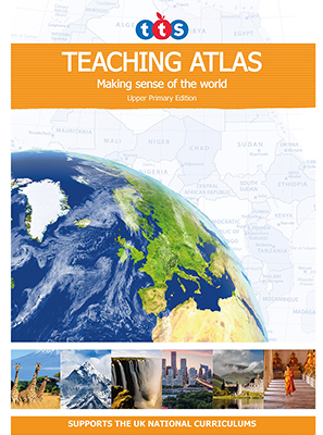
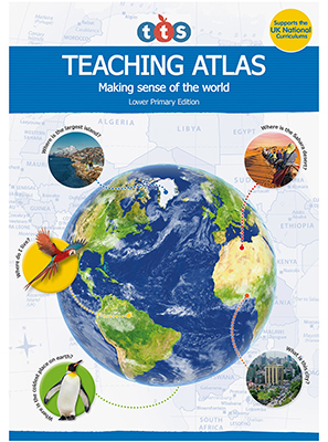
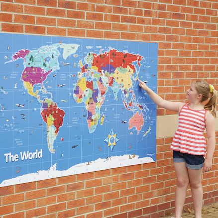
The Research Review also foregrounds the use of maps in making geographical learning visible. This involves both map-reading and map-making, and the latter should become more spatially accurate as children move into upper KS2. As I argued in 2016, using a variety of maps is also helpful. Simon Catling offers some outstanding ideas about progression in map work. The TTS Teaching Atlases not only offer a clear progression thread through KS1 and KS2, but also provide a great variety of high quality maps and age-appropriate activities.
Resourcing
Where do you look for outstanding examples of planning? For engaging activities that will also drive outcomes?
Here are some sources that I find useful and reliable:
- TTS blogs on atlases and mapping
- The Geographical Association
- Royal Geographical Society (with IBG)
- Digimap for Schools
- Oddizzi
Impact – what have pupils learned?
The Ofsted Handbook (2019) makes it clear that knowledge “must not be reduced to, or confused with, simply memorising facts.” This means that – while facts might be useful to support them – what we are most interested in assessing at end points is the ‘big ideas’, concepts and key skills that children have acquired.
We may well want knowledge to be ‘sticky’, but we don’t want it to be ‘bitty’.
Having three headline outcomes for knowledge and a similar number for skills by the end of a Geography-led topic is what I would normally work with.
Opportunities for extended writing, as specified in the 2014 Programmes of Study, are a crucial vehicle for these summative end-point assessments. I think it can be really useful to build an age-appropriate writing task into a scheme of work, especially if that task is something that children are building up towards across several lessons. This task can be carefully designed so that children are given prompts which ask them to demonstrate what they have learned in order to complete it. I have seen some great examples of schools which artfully link the extended writing task to a genre that children are working on that term (e.g. setting description, persuasive text, letter-writing, newspaper article).
Here’s an example …
At the end of a Year 2 unit which looks at a neighbourhood in Lima as a contrasting locality, children write a postcard to the UK, in role as Paddington’s Aunt Lucy (who lives in ‘darkest Peru’). They choose 2-3 of images for the front of the card that they would like her to show to Paddington, then write a message on the back that includes: the name of the place she is in, including the city, country and continent; what the weather is like there; one thing that he might like to see when he visits; something that will be familiar to Paddington; one thing that may strike him as unusual. Children then address it to Paddington in the UK. (Less confident writers can be helped in the writing part of the task: it is the content that matters here).
This task allows the teacher to check if children have understood the location of Lima, several of its key features; its climate and ways in which it might resemble or be different from familiar places in the UK. As a supplementary task, children can be asked to draw a line on an outline world map that shows where the postcard is travelling from and where it will arrive.
Both expected outcomes and written tasks will become more demanding as children progress. I think it is helpful, for example, to evaluate if children are capturing a strong ‘sense of place’ in their writing by Years 5 and 6. Oddizzi (see above) offer a good range of examples of written end-point assessments.
Coming full circle, the assessment of a child completing a written activity will show their progress against intended end-points for that topic, which in turn will have been sequenced against end points in other Geography topics and in other years. These should in turn ultimately match up against the whole school’s priorities for the subject. Those priorities are ultimately determined by local, national and global circumstances. So the process as a whole, from the individual child and the specific task, through to the whole wide world, can also be understood through the geographical ‘big idea’ of scale. That is perhaps a lesson in itself?
With many thanks to Ben Ballin for sharing his advice, experience and expertise with us.
Ben Ballin is a primary consultant specialising in geography and global learning. He is the author of the TTS Upper Primary Teaching Atlas.