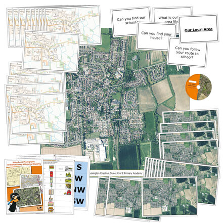
Aerial Photography School Map Classroom Pack
https://www.tts-group.co.uk/aerial-photography-school-map-classroom-pack/1053132.html Product Code: GH47393Promotions
Product Actions
Helping to Support Teaching and Learning
-
Comprehensive Pack
To ensure thorough geographical studies, a comprehensive class pack of OS maps and aerial photographs is available.
-
Includes Teachers' Notes
Provides structured guidance and activity suggestions. Includes teachers' notes and prompt cards of your local area.
-
Reusable Materials
For long-term classroom use, durability is key. Laminated maps and notes meet this need by being reusable.
-
Interactive Learning
Enhancing interactive learning experiences, the CD of maps and aerial photographs can be used on whiteboards.
-
Geographical Skills
Helps children use fieldwork to observe, measure, record, and present human and physical features. Supports Key Stage 2 geographical skills and fieldwork.


