TTS Teaching Atlas

Product Code: make all selections to view product code
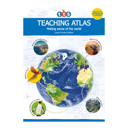
A specially designed Teaching Atlas to fully support all areas of the UK geography curriculums.
Read more

Product Actions

Add to cart options

Variations

Please make all your selections
From £9.99 ex VAT
Please make a selection

Helping to Support Teaching and Learning

  • In partnership with the Geographical Association

  • Supports the UK Geography Curriculums

  • Available in two editions; Lower Primary and Upper Primary

Your TTS photos

Tag your photos #takingoverTTS

TTS Teaching Atlas

A specially designed Teaching Atlas to fully support all areas of the UK geography curriculums.

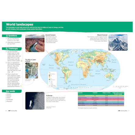
  • Includes high-quality cartography with added content to support the development of key geographical knowledge through enquiry and independent investigation, mapping, fieldwork, extending vocabulary and supporting critical thinking skills.

  • The Lower Primary Teaching Atlas is suitable for supporting the lower primary geography curriculums, with questions throughout to encourage the use of maps and geographical thinking. Additional questions called ‘Challenges’ provide opportunities to apply knowledge and deepen understanding. Written by Paula Owens, former Curriculum Development lead for the Geographical Association (GA) and member of the Editorial Collective of Primary Geography.

  • The Upper Primary Teaching Atlas is suitable for the upper primary geography curriculums with ‘Big Questions’ throughout. These questions support children to critically investigate a range of topics, encouraging the use of maps, debate, research and understanding data. Written by Ben Ballin, Geography Primary Consultant Specialist and member of the Editorial Collective of Primary Geography. The upper primary edition also supports the history curriculums with dedicated pages throughout, providing information on key historical events and civilisations, perfect for schools who plan their geography and history lessons together. The consultant for historical content is Alf Wilkinson, History CPD advisor and active member of the Historical Association (HA).

  • When the Teaching Atlases are used together throughout primary education, they support a child to have a better understanding of geographical concepts by developing their sense of place in the world. The Teaching Atlases also supports well-being by getting children to think about their rights, values, ethics and beliefs; empowering them to make informed choices about sustainability, impacts of their actions and engaging with local, national and global issues.

    Overview

    Features
  • Orientation:

    Portrait

Questions

Reviews