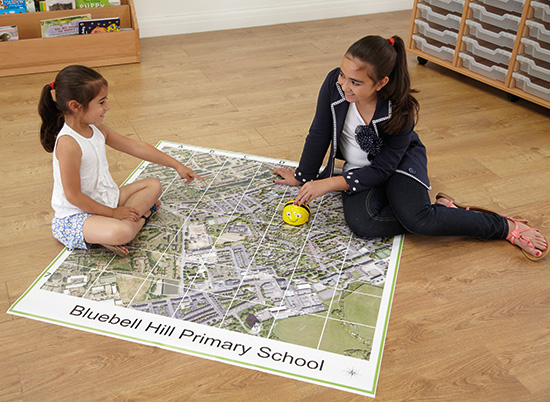
Engage your children at an early stage with maps, your local area and grid referencing with Local Area mapping so they can plan and follow their journey to and from school and beyond!
Lesson activity idea:
Use an aerial map of your school and ask your children to spot something, be it a road, tree or building that they recognise and get them to write down its features – then get them to swap with a partner to see if they can find each other’s point of interest on the Map.
If you are using an Interactive whiteboard with Aerial Mapping, you could get the children to come up one by one and point out to the class their chosen feature and explain why they picked it.
You may want to extend the task with the children by getting them to talk about the similarities and differences of some of the features of their local area. Encourage them to use all of the key vocabulary for extra curriculum coverage.
Your children will be able to name and talk about numerous physical or human features by the end of this task hitting key Geography curriculum points such as:
- Use observational skills to study the geography of their school and its grounds and the key human and physical features of its surrounding environment.
- Observe, measure, record and present the human and physical features in the local area using maps, plans and digital technologies.
- Understand geographical similarities and differences through the study of human and physical geography of a region of the United Kingdom
The above points have been adapted from the DfE’s Geography programmes of study. You can read or download the full PDF version here
We’d love to hear how you utilise Aerial Mapping in your school so please share your comments and pictures with us on Twitter


