Images

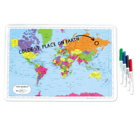
Write & Wipe World Tabletop Map

Product Code: make all selections to view product code
A double-sided, erasable world map that enhances geographical learning and skills.
Read more

Product Actions

Add to cart options

Variations

Please make all your selections
From £4.99 ex VAT
Please make a selection

Technical Summary

Overview

Helping to Support Teaching and Learning

Interactive Learning

This map enhances children's geography skills through active exploration and practice on a dual-sided design.

Reusable Design

Constructed for repeated use, this map can be used over and over again, providing a sustainable option for classrooms and reducing the need for disposable teaching materials.

Dual-Sided Utility

Enhances learning opportunities by featuring a vibrant world map on one side for geographical explorations and a blank template on the other for basic labelling and other teaching needs.

Flexible Pack Options

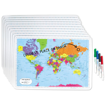
Available in three pack sizes: single, pack of six, or pack of thirty, catering to different class sizes and teaching requirements.

Key Stage 1 Support

Supports Key Stage 1 curriculum by helping children use maps to identify major geographical features and develop observational skills.

Your TTS photos

Tag your photos #takingoverTTS

Write & Wipe World Tabletop Map

A double-sided, erasable world map that enhances geographical learning and skills.

Overview

  • Enhance your geography lessons with this versatile, write-and-wipe world map. Ideal for hands-on learning, it encourages children to discover and interact with geographical concepts by marking and erasing as needed. The durable design allows for repeated use in various educational activities.

  • The map supports the Key Stage 2 curriculum by assisting in the teaching of locational knowledge related to latitude, longitude, and various global circles. It serves as an excellent tool for comprehending concepts like the Equator, Northern and Southern Hemispheres, as well as the Prime Meridian.

  • Additionally, the map helps Key Stage 1 children identify the UK, its countries, and other major world regions through practical engagement. It also supports fieldwork skills, enabling children to observe and record physical and human features of their surroundings.

Supports the National Curriculum

Geography, Key Stage 2, Geographical Skills & Fieldwork

Use maps, atlases, globes and digital/computer mapping to locate countries and describe features studied.

Geography, Key Stage 1, Geographical Skills & Fieldwork

Use simple fieldwork and observational skills to study the geography of their school and its grounds and the key human and physical features of its surrounding environment.

Geography, Key Stage 1, Geographical Skills & Fieldwork

Use world maps, atlases and globes to identify the United Kingdom and its countries, as well as the countries, continents and oceans studied at this key stage.

Technical Summary

Overview

Questions

Reviews